
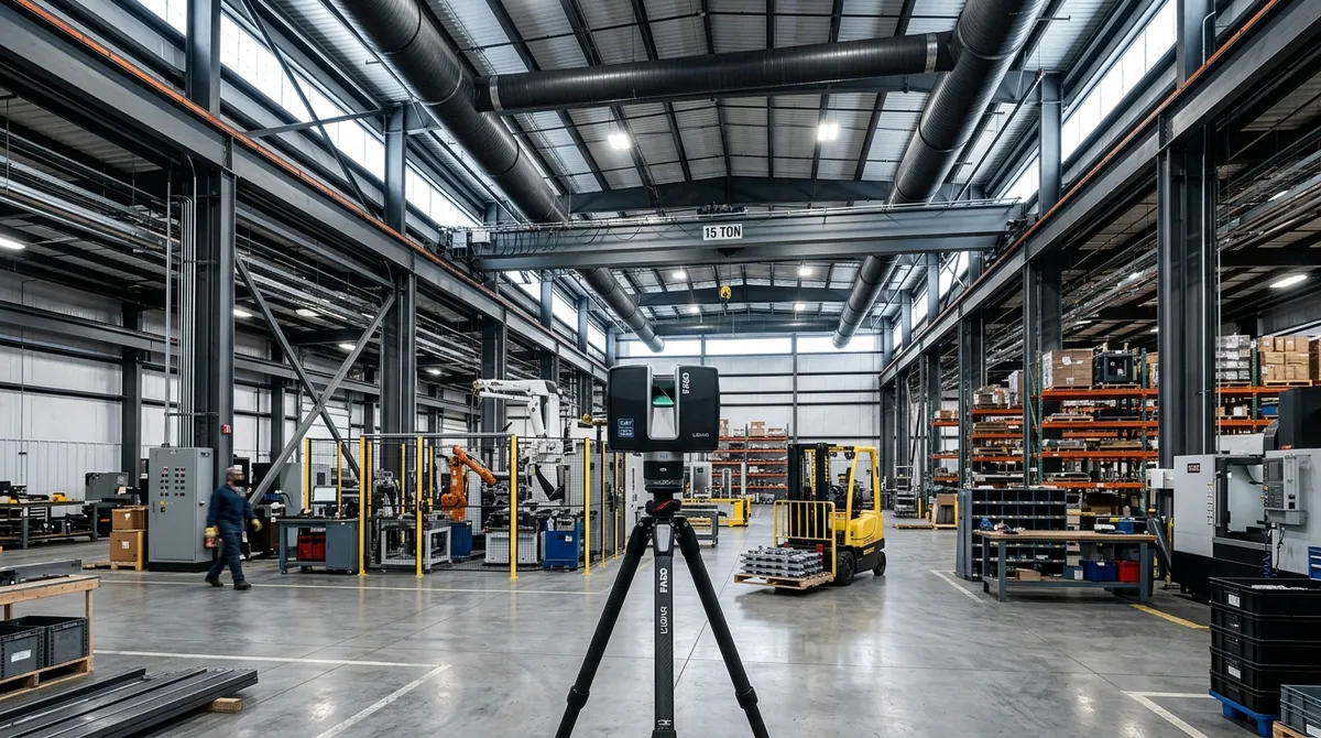
Facilities Management & Operational Digital Twins
Connect IoT telemetry, BMS sensors, and CMMS work order tickets directly inside millimeter-accurate 3D digital twins.
How 3D Reality Capture Transforms Facilities & Building Operations
Digital Strada transforms raw reality capture into structured operational digital twins. We link equipment specifications, maintenance history, and live IoT data directly to spatial assets.
🎯 Key Outcomes & Deliverables for Facilities & Building Operations
Enterprise Software Systems & Platform Implementations
We don't just deliver 3D scans. Digital Strada provides enterprise software integration, custom API development, IoT sensor telemetry, and AI spatial guide avatars across industry-leading platforms.
3D Smart Building IoT & 4D Construction Timeline
Smart Building 3D IoT facility management platform & 4D construction milestone progress tracking.
- Live BMS, HVAC, energy, and occupancy IoT sensor telemetry in 3D
- 4D timeline comparison between planned BIM models and physical scans
- Enterprise software licensing, setup, and custom API integration
Matterport Enterprise & Pro3 LiDAR
High-density 3D spatial reality capture (±20mm @ 10m), structured E57 point clouds, and custom SDK/API development.
- Pro3 LiDAR scanning with up to 100m range, 100,000 pts/sec rate, under 20s sweeps, and ±20mm @ 10m precision
- High-density point cloud extraction (.E57, .XYZ) and 3D Mesh (.OBJ)
- Mattertag asset tagging and custom Matterport Core SDK/API embedding
24/7 AI Spatial Guide & AR Connected Worker System
24/7 AI conversational virtual guide avatars, AR smart glass telemetry, and live video sales tours.
- Conversational AI virtual guide avatars active 24/7 inside 3D space
- Generative AI interior redesign and mobile camera AR indoor wayfinding
- AR smart glass telemetry and spatial safety warnings for plant workers
AutoCAD & Revit Compatible As-Built Deliverables
As-built spatial data conversion into BIM (.RVT, .IFC) and CAD (.DWG, .DXF) files fully compatible with AutoCAD, Autodesk Revit, and major AEC software.
- As-built 2D CAD drawings (.DWG, .DXF) compatible with AutoCAD for architects & engineers
- As-built Revit BIM models (.RVT, .IFC OpenBIM) built up to LOD 350 for AEC design teams
- Precise spatial geometry extracted from 3D LiDAR point cloud scans ready for AEC software
White-Label Enterprise 3D Viewport Overlays
Custom corporate UI navigation skins, multi-language switching, audio guides, and gated access.
- White-label brand skin customization with custom menus, logos, and fonts
- Multi-language language switching directly inside the 3D model viewport
- Background audio guides, password protection per room, and deep-linked tags
Procore Construction Management Integration
Embed Matterport 3D digital twins and spatial deliverables directly into client Procore project workspaces for unmatched visual site context and issue resolution.
- Attach RFIs, Observations, and Punch List items directly onto 3D Matterport spatial tags inside Procore
- Streamline construction closeout and quality control with a single 3D visual source of truth
- Turnkey delivery of Matterport add-ons (.RVT Revit BIM models, .E57 point clouds, MatterPaks) directly to client Procore accounts
Autodesk Construction Cloud (ACC) & Revit Integration
Integrate 3D LiDAR reality capture and Scan-to-BIM deliverables directly into Autodesk Docs, Build, BIM 360, and Revit for accelerated AEC workflows.
- Autodesk Build 3D RFIs & Observations: Pin jobsite issues to exact 3D spatial coordinates inside ACC
- Autodesk Docs & BIM 360 Partner Cards: Centralized 4K spatial digital twin visibility on project dashboards
- Autodesk Revit (.RVT) & ReCap (.E57): Direct point cloud & parametric BIM import up to LOD 350
Property Sites & Mobile AR Module
Turnkey single-property marketing web page with built-in lead generation forms and mobile AR Quick Look previewing 3D property assets on smartphones.
- Schematic 2D/3D floor plans with Gross Internal Area (GIA) calculations
- Single property marketing web landing pages with lead capture forms
- Mobile AR Quick Look 3D product placement for retail & real estate
Actionable 3D Scan Add-Ons & Engineering Deliverables
Extract structured CAD/BIM data, high-density point clouds, and instant insurance loss sketches directly from our Matterport Pro3 High-Density 3D LiDAR scan data.
Schematic 2D/3D Floor Plans
PDF | PNG | SVG2D schematic floor plans with room labels, precise wall dimensions, and Gross Internal Area (GIA) calculations delivered within 24-48 hours.
BIM File Bundle (Revit & IFC)
.RVT | .IFC OpenBIMAs-built 3D Building Information Models containing structural elements, walls, slabs, windows, doors, and MEP systems modeled directly from 3D scan data.
e57 Registered Point Cloud
.E57 (ASTM E2807 Standard)High-density LiDAR point clouds containing 3D spatial coordinates, RGB color data, and sensor origin positions for complex BIM & CAD reverse engineering.
MatterPak™ Data Bundle
.XYZ | .OBJ Mesh | Floor Plan PNGComplete architectural data bundle containing colored point clouds, 3D mesh OBJ files, ceiling plans, and high-resolution floor plans for direct CAD import.
AutoCAD Compatible 2D/3D CAD
.DWG | .DXFClean, layered architectural CAD floor plans, structural section cuts, roof plans, and exterior building elevation drawings fully compatible with AutoCAD & BricsCAD.
TruePlan™ for Xactimate
.SKX Xactimate SketchTurnkey 3D insurance claim sketches delivered directly into Xactimate for rapid property loss estimation and insurance claim adjustments.
Configure Your 3D Scanning, Scan to BIM & Software Proposal
Select your project area, space parameters, preferred currency, and required engineering deliverables below for a tailored technical proposal benchmark.