
Museums & Heritage
Ballywalter Beach & Park - Coastal Heritage 360° Virtual Tour
Ballywalter, Northern Ireland• Area: 180,000 m²
360° Coastal PhotogrammetryGoogle Maps Street ViewMarine Tourism MappingHDR Panoramas
Request Similar 3D ScanProject Overview
Building Background & Context
Ballywalter Beach features miles of pristine sandy shores, historic limestone harbour walls, and family recreational parks on the Irish Sea. Digital Strada mapped the shoreline in 360°.
🎯 The Challenge
Harsh coastal winds, shifting tides, and bright sunlight reflections off the open sea and wet sand.
💡 The Technical Solution
Time-synchronized HDR spherical capture during optimal tidal windows, creating smooth coastal navigation on Google Maps.
Project High-Res Photo Gallery
1 photos & 3D spatial captures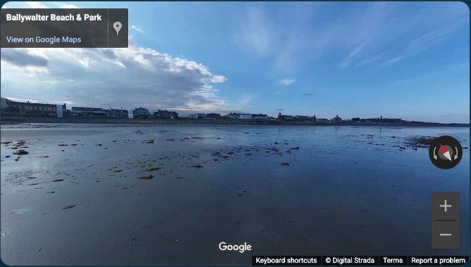
Ballywalter Beach & Park - Coastal Heritage 360° Virtual Tour - High-Resolution 360° Photogrammetry & Viewport
📦 Deliverables Produced for Client
- Coastal 360° Virtual Walkthrough
- Google Street View Beach Mapping
- Ultra-HD HDR Panoramas
- GIS Shoreline Coordinates
Measurable ROI
Client Value & ROI Achieved
60,000+ Annual views on Google Maps
Promoting coastal tourism in the Ards Peninsula
Remote accessibility for beachgoers
Have a Similar Space to Scan?
We provide high-precision Matterport Pro3 LiDAR scanning, Scan-to-BIM, and custom software integrations globally.
Start Your 3D ProjectRelated Reality Capture
Featured 360° Tours & Spatial Projects


Custom 3D Engineering Proposal & Scope Builder
Configure Your 3D Scanning, Scan to BIM & Software Proposal
Select your project area, space parameters, preferred currency, and required engineering deliverables below for a tailored technical proposal benchmark.
m²
50 m²2,500 m²5,000+ m²
Tailored Engineering & Spatial Consultancy
Configured Scope Summary
250 m² • Commercial Office / Retail Space
⚡ Calculated Scope Analysis:
Custom Engineering Proposal
* 3D & BIM projects are tailored based on site parameters, timeline, and custom specifications.
🛒 Selected Scope Deliverables:
2D Schematic Floor Plan (GIA)
All project data is strictly confidential and routed directly to Digital Strada Team.